Local View: Duluth can follow bikeways plan for active transportation

Source: Duluth News Tribune 11-25-18 Local View: Duluth can follow bikeways plan for active trans…

By Ruurd Schoolderman on Nov 25, 2018 at 7:30 p.m.

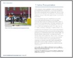
Duluth has been making great progress as an active outdoor-recreation community. We are well on our way toward achieving the goal of having every citizen within a mile of an access point to Duluth’s trail system. The Duluth Traverse mountain biking trail and Superior Hiking Trail string together Duluth’s many neighborhood parks. Amenities like these make Duluth an attractive city to live in and to visit and are part of the city’s overall economic-development strategy.

This great investment to improve access to our green space by bike and on foot stands in contrast with the limited bike infrastructure that currently exists to safely navigate our neighborhoods and city for day-to-day active transportation. This is a missed opportunity.

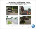
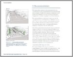
The Duluth-Superior Metropolitan Bikeways Plan presents a vision to change this. The plan was prepared by the Duluth-Superior Metropolitan Interstate Council, or MIC, a regional transportation-planning agency. The plan serves as a coordinating framework for the road authorities (city, county, and state) responsible for our road system.

The Duluth Bike Coalition, a chapter of the statewide bike advocacy group BikeMN, advocates for improvements to Duluth’s bike infrastructure. Our mission is to work to make biking for everyday transportation easy, safe, and fun for everyone.

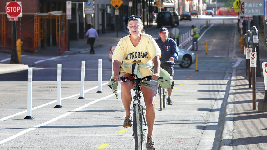
Our current bike-transportation infrastructure for everyday transportation to work, school, and businesses does not serve users of all ages and abilities. As a result, a large portion of Duluth’s citizens which does not have access to a car or prefers not to drive is limited in transportation options. Think about low-income families, teenagers, and the many Duluthians who prefer to ride a bike as part of an active-transportation lifestyle.

Duluth Bikes supports the vision presented in the Duluth-Superior Metropolitan Bikeways Plan. We ask that the roadway authorities, especially the city of Duluth’s, make a concerted commitment toward implementing this vision. We hope the city of Duluth will use this plan to proactively work to develop access to bike infrastructure for all ages and experience levels.

Two open houses organized by the MIC are scheduled so the public may comment on the bike plan. They are a great opportunity for Duluth citizens to show their support for active transportation and to provide input on how they would like to see Duluth’s bike infrastructure improved.

Ruurd Schoolderman is chairman of the Duluth Bike Coalition (duluthbikes.org), a chapter of the statewide bike advocacy group BikeMN (bikemn.org).

Get involved

Two open houses are scheduled for the public to review and to provide feedback on the draft Duluth-Superior Metropolitan Bikeways Plan. The open houses are both Wednesday — one from 11:30 a.m. to 1 p.m. and the other from 4-7 p.m. — at the Duluth Folk School, 1917 W. Superior St.

To read the bike plan, go to dsmic.org/study/dsbikeways.

The INTERNal Outsider: Adventures in Excel

An Intern’s-Eye View of the MIC


Bikes, peds…

Did you realize that on just fourteen streets in Duluth and Superior during one 12-hour period in September, there are around 1,240 uses of infrastructure by bicyclists, and 5,896 uses of infrastructure by pedestrians? The entire town I live in (around 900 people) would have to walk back and forth more than six times to get that pedestrian count.

I am going to guess that your answer is no, you had no idea the extent of the infrastructure used by alternative transportation in Duluth and Superior.

I’m also guessing that most of you also don’t know the extent of the effort that goes into this 5×19-cell table.BP Count Spreadsheet-314px

This is the fourth year of the biannual bicycle and pedestrian counts. James Gittemeier, senior planner at the MIC, and Shawna Mullen-Eardley of the Healthy Duluth Area Coalition determine count data sites, recruit and coordinate volunteers, and lead volunteer training. After attending training, each volunteer* is asked to sit for two hours at a count site and fill out a form noting direction of travel, users by demographic (male, female, child, using assistive device), and mode of transportation (walking, biking, “other”). (The method for the count was created by the National Bicycle and Pedestrian Documentation Project).

Are you getting a better idea of what goes into this seemingly simple chart?

After the day is over and all of the forms are gathered, the amazingly talented and intelligent intern (hey that’s me!) gets to decipher the notes of dozens of volunteers. The data gets entered into Excel by 15 minute increments for each demographic and each mode of transportation. Lucky for me, there is already an Excel spreadsheet that is set up to create the totals. I then finagle Excel to make those totals magically appear into this chart.

Don’t think this chart is the final product, either! After the data is entered and the totals are gathered, we begin an analysis of how the trends in the data will have an effect on future decision making for alternative transportation infrastructure. Excel is very useful in the analysis portion. So far I’ve created around 50 charts to get a better idea of visible trends.

Although I will concede that the data is not perfect – human error in counting and entering the data – the numbers tell an interesting story: The people of Duluth and Superior are outside and active.

*A huge thank you to all volunteers whether you did more than asked or did just as much as you could

…and buses (oh my!)

I can’t talk about all the time I’ve spent in Excel the last two weeks without also bringing buses into the mix.

Robert Herling, my supervisor and another senior planner at the MIC, has been researching the infrastructure use in the Lincoln Park for the Multi-modal Study that’s underway for that neighborhood.

One important aspect of this research is looking into the use of public transit.Garfield bus stop bus in sight-175px

Have you ever had to transfer between two city buses to find that either the last one left just minutes prior to your arrival, or you have less than five minutes to get to the bus stop on the other side of an intersection? You should try it some time.

Robert tasked me with finding out how often this occurs for a few of the major transfers in the Lincoln Park area, from the mainline at 21st Ave W and Superior Street to the mall lines, as well as the mainline at Superior Street and Garfield to the Superior, Wisconsin line. A misstep in scheduling is not a rare occurrence for these bus users, but don’t fret! Our loyal transit authorities are not overlooking this issue.

Thanks for taking the time to join me on my journey to find out what the MIC is all about. Now I must get back to my spreadsheets.

What will our Transportation System Look Like in 2040?

Updating the 25-year Vision for Transportation in the Twin Ports

Mode Horizontal Image Strip-530px


You are invited to attend one of the four public meetings on Connections 2040 – the Twin Ports Long Range Transportation Plan.


The Duluth-Superior Metropolitan Interstate Council (MIC) is updating its Long Range Transportation Plan (LRTP) to provide policy guidance, goals and strategies for jurisdictions within the greater metropolitan area of Duluth, Minnesota and Superior, Wisconsin.  It covers a twenty-five year planning horizon and is updated every four years.Connections2040-logo-320px

The over-arching purpose of the LRTP is to provide a planning foundation for jurisdictions to work cooperatively to provide a well-maintained, integrated, accessible and multi-modal transportation system to safely and efficiently move people and freight for the next 25 years, within the constraints of funding the region can reasonably expect to receive.

The heart of the Plan is a listing of proposed federally-funded transportation projects, as well as transportation initiatives underway within the region, to be implemented from 2015-2040. You can view an interactive map of the projects here.

To learn more about demographic trends for this area, projections, transportation priorities and planned projects, you have three opportunities for input:

1. Attend a Public Meeting

Thurs. Sept 11, 2014
5:00-7:00pm
Community Action Duluth, 2424 W 5th Street, Duluth, MN 55806

Thurs. Sept 18, 2014
4:00-6:00pm
Superior Public Library, 1530 Tower Avenue, Superior, WI 54880

Thurs. Sept 25, 2014
4:00-6:00pm
Arrowhead Regional Development Commission (ARDC)
221 W First Street, Duluth, MN 55802

Mon. Sept 29, 2014
4:00-7:00pm (drop-in)
214 West Superior Street
221 W First Street, Duluth, MN 55802

2.  Visit our Connections 2040 web page at www.dsmic.org/lrtp for more information about the plan and to view the interactive map of proposed projects.  You can use the “layers” tab in the upper right corner to toggle on and off views of information about environmentally sensitive areas, low-income and minority populations, etc.

3.  Contact MIC Senior Planner James Gittemeier by phone at (218) 529-7556 or by email at jgittemeier@ardc.org.


Lincoln Park Multimodal Study (2016)-2

This plan identifies issues and makes recommendations to improve safety and connectivity for all modes of transportation in the Lincoln Park neighborhood of Duluth, Minnesota.

Click to view plan

Complete document (75 MB)


Click to view document

Executive Summary (95 kb)


Document is presented here in sections (to reduce PDF size):

Click to view doument

Part 1 (10 MB / 22 pp)
Summary / Table of Contents /
Introduction / Stakeholder Involvement


Click to view document

Part 2 (19 MB / 38 pp)
Land Uses / Demographics /
Growth Scenarios / Road Network


Click to view document

Part 3 (22 MB / 27 pp)
Freight Network / Transit System


Click to view document

Part 4 / (10 MB / 32 pp)
Active Transportation–Bicyclists and Pedestrians /
Multimodal Integration / Safety


Click to view document

Part 5 (18 MB / 29 pp)
Recommendations and Appendix

Bike-Friendly Duluth?

As cities across the U.S. are battling it out for the distinction of “Most Bike-Friendly,” does Duluth stand a chance of being included some day in the Top-50 list?

You might think that our long winters and steep hills would prevent this. But think again: two of the top-ranked cities, Portland, Oregon (back to #1 this year) and Minneapolis (dropped to #2) are neither sunny nor warm places for much of the year-Portland is rainy , cool and hilly and we know all about the cold and snowy winters of Minnesota.

Consider also that two other cities – Boulder, Colorado (#3), which is comparable to Duluth in its total population and San Francisco, California (#8) – feature many or more of the same topographical obstacles we face here.

So what does it take to get on this list?

In addition to having a significant interest in cycling on the part of its residents, a city needs to be willing to be proactive and try new things.

In some ways Duluth has operated this way, to promote bicycling as a transportation option. For example,

  • The DTA was an early adopter of the bike racks on the front of buses.
  • There is a dedicated lane on Park Point (from April to October) for non-motorized users.The Bong Bridge (U.S. Hwy 2/53) connecting Duluth and Superior includes a separate, protected bicycle and pedestrian lane.
  • The City of Duluth and St. Louis County are creating space for bicyclists and pedestrians by adding shoulders where possible when reconstructing streets, including on parts of Arrowhead Road, Wallace Avenue, Snively Road and the new space created on Glenwood Street.
  • The Lakewalk (and the future Cross City Trail link that will connect the Lakewalk to the Munger Trail) is a bike-friendly, off-street link that will  run the entire length of Duluth.

These are highly visible bike-friendly amenities.  However, what is missing is just as noticeable:

  • Roads commonly labeled by local bicyclists as unsafe or dangerous—Superior Street in Downtown Duluth, Woodland Avenue around UMD, and 4th Street near the hospitals —are the very streets that should be the most accommodating. Although these major streets carry a quite a bit of car traffic, they are also ideal for bicycling, as they provide the most direct route to major destinations and generally have less severe slopes than other streets.
  • Other streets and public spaces, including intersections and routes on top of the hill near the Mall where bicycling has not been given a whole lot of thought, are enormous impediments to bicycling in this region.

But we also have some opportunities in our near future for the Twin Ports community to be proactive in a couple of upcoming projects:

  • Belknap Street, in the City of Superior,  is being considered for some type of bicycle accommodation that would complement the planned bike lanes on Tower Avenue as part of their downtown streetscape project.
  • A big opportunity in Duluth is the new DTA Multimodal Transportation Terminal, a part of which is a new “northwest passage” skyway connecting Downtown Duluth and the DECC.  This facility has the opportunity to serve as a bike station as well as provide a safe and convenient bicycle path across I-35 to and from the core downtown area.

So, what do you think? What’s your experience with biking in Duluth? Do we have the commitment that’s necessary to bring our city up to the level of one of America’s most bike-friendly cities? What do you see as opportunities—or opportunities lost—for improving biking here?

More Bikeable than You Might Expect

Steep hills and long cold winters are a fact of life here in Duluth, MN – and pose a significant barrier to commuting by bike in this town.

But there’s also the Lakewalk and its planned extension across the length of the City, providing a safe and scenic off-street route; signed onstreet bike routes; a few miles of dedicated bike lanes; and ways to make it up that hill.

Not to mention, it’s summer.  The cyclists are out in force and several of them stopped by our Lake Avenue bike station on Bike to Work day a couple of weeks ago.

As you’ll see from our video interviews, they come from every part of the city, feel that the advantages of biking far outweigh the disadvantages, and generally find biking to work a very viable option.

Check it out – and perhaps be persuaded that any day can be Bike to Work day.

Video footage by Robert Herling and Rondi Watson; editing by James Gittemeier

Twin Ports Bike to Work Day

Twin Ports BIke to Work Day 2012 logo

What if this Friday you left the car in the driveway and rode your bike instead?

Twin Ports BIke to Work Day 2012 logoOn Friday, May 18th, we invite you to ride your bike to work.

We’ll have a couple of bicycle stations open, on both sides of the bridge, from 6:30 am to 8:30 am. Stop by and reward your commute with:

  • Free coffee and refreshments
  • Bike mechanics to look at brakes, tire pressure and other safety checks
  • Copies of the Duluth-Superior Bike Map

The bike stations will be located at:

  • Duluth: Lake Ave &Superior Street (Minnesota Power Plaza)
  • Superior: Tower Ave & Belknap Street (City Center Park)


We think you’ll enjoy the ride. Biking can enhance your physical health, mental outlook and even improve the rest of your work day.  Give it a try and see for yourself!

Why do YOU bike to work?

We interviewed a few folks in and around our office about their reasons for biking to work.  Their message: biking is a healthy, economical and fun transportation alternative.

httpv://www.youtube.com/watch?v=xxiNQu5qK_0

We hope you’ll be inspired or encouraged to join us for Bike to Work Day on
Friday, May 18.

You’re invited to stop by one of our bike commuter stations from 6:30 am
to 8:30 am and reward your commute with:

  • Free coffee and refreshments
  • Bike mechanics to look at brakes, tire pressure and other safety checks
  • Copies of the Duluth-Superior Bike Map

The bike stations will be located at:

  • Duluth: Lake Ave &Superior Street (Minnesota Power Plaza)
  • Superior: Tower Ave & Belknap Street (City Center Park)
  • Stop by and tell us why YOU biked to work!

    Click to see our Bike to Work event page on Facebook

    Video footage and editing by Robert Herling, Jodi Jabas and James Gittemeier

    Carless in Duluth

    It’s no secret that we Americans are in love with our cars.

    They demonstrate our status and standing in society.

    The way we’ve invested in roads and highways and the way we’ve developed our cities pretty much mandates that you need to own a car to be able to access jobs, food, education and recreation.

    Driving a car has become the default mode of travel for almost all people for every trip of any distance.

    And here in Duluth, perched on a steep hill with prominent winters, it makes sense that people want to drive.

    So why would a person choose not to?

    Video documentary and panel discussion

    Carless in Duluth, a video documentary about people who walk, bike, or take the bus instead of driving, will premiere on:

    Tuesday, March 20, 2012
    6:00 pm
    Teatro Zuccone
    222 East Superior Street, downtown Duluth

    Following the video, there will be a panel discussion with engineers, planners, and other experts in the area.  Afterward, an informational tabling session will be held in the atrium where food and drinks will also be available.

    Area bike and ped projects, and lots of them

    The event, hosted by the Healthy Duluth Area Coalition, follows a series of public meetings that were hosted throughout Duluth about one month ago.  At each meeting, residents were given the opportunity to learn about ongoing and upcoming bicycle and pedestrian projects happening all over the city, including the Cross-City Trail, the Duluth Citywide Sidewalk Study, and the Duluth Traverse Mountain Bike Trail, and gave their feedback about their interest in these projects as well as other potential ideas. Over 50 residents participated in these meetings.

    The Carless in Duluth premiere and transportation forum on March 20th will conclude this series of public outreach events. Organizations including the Duluth Transit Authority, the Metropolitan Interstate Council, City of Duluth Engineering, and the Bike Cave Collective have already confirmed their participation in this event, with pending confirmation from the Northern Lights Express, COGGS, and the UMD Cycling Club.

    Check it out – it’s free and open to the public.

    My Awesome Walk to Work

    Snow-covered section of the Superior Hiking Trail in Duluth MN

    My Facebook post today reads: “Another awesome walk to work this morning on the Superior Hiking Trail—despite the snow—or maybe because of it!”

    Within seconds a friend (an actual friend, in this case) responded “I did the same. I love Chester Park.”

    Another commented “You are the luckiest commuter ever!”

    This exchange reminded me of the simple, real-life benefits of one of our favorite concepts here at the MIC: multi-modal transportation networks.

    It’s all about options

    From a transportation planning perspective, a multi-modal transportation network refers to a balance of  infrastructure that supports multiple modes of travel — a mix of roads, air, marine/port, rail, public transportation, bicycle and pedestrian facilities (including paved and non-paved trails).  This mix is plainly visible on any given day in the Duluth-Superior area.

    From a societal and governmental perspective, multi-modal transportation networks have been widely supported because a balanced transportation system encourages economic growth, reduces congestion and environmental impacts, and improves mobility and access to transportation.

    From my personal perspective, though, a multi-modal transportation network means that I have options. It was just too nice of a morning to get in my car and drive (the very walkable distance of) two and a half miles.

    Trails as commuter pathways

    One big advantage of living in Duluth, Minnesota, is the proximity of urban areas to green spaces. A multi-modal system, in this city, means that I can walk out my back door onto the Superior Hiking Trail, which in turn intersects with our urban streets infrastructure across Skyline Parkway (as scenic a walk as you could ask for), down through a couple of local neighborhoods and to our downtown office.

    And a community-wide vision is emerging for Duluth to become the premier trail city in North America. Developing an inter-connected trails system will provide not just outstanding recreational opportunities but compelling transportation options as well.

    Quality of life improvement

    Bottom line, I don’t have to get in my car and drive every time I need to go somewhere. I’m able to travel on foot (or by bike or by bus), and I consider that a big quality of life enhancement.

    How about you?

    Do you have an awesome walk to work of your own?  Would you like to be able to walk or bike more often in your daily life?  Does it make sense to continue to fund multi-modal transportation networks? (More on that topic to follow…)

    Our Love/Hate Relationship with Central Entrance

    Just last week I dropped a friend off near Arrowhead Road and Highway 53 just before 8 a.m. and headed toward my office in downtown Duluth.  I glanced at the dashboard clock and it said 7:58.  I had anticipated a congested trip but traffic was fairly light.

    Love It

    I made my way downtown thinking about my upcoming work day, scored a (free) parking spot, and to my surprise saw my car clock said 8:05.  Seven minutes to go five miles on Central Entrance, of all routes.  I had to admit that was an easy and direct commute.

    Hate It

    Fresh in my memory, however, are recent after-work trips to Miller Hill to run errands where I waited out more than one cycle of traffic light changes at Arlington Road and Central Entrance.  I–like everyone else–get frustrated by sitting in traffic.

    But I think that we get frustrated much quicker than big city drivers who have horror stories about the amount of time they get stuck in traffic.  Relatively speaking, we have it pretty good.  So what is it about Central Entrance that makes many of us want to avoid it?

    The Bigger Picture

    From a transportation standpoint, it’s not just about reducing vehicle congestion on this road, but about balancing the needs of all users.  In transportation planning, we think about  improving Central Entrance from many perspectives, including:

    • Mobility (getting travelers through the area)
    • Access (getting customers to local businesses)
    • Multimodal (accommodating pedestrians, bicyclists and transit users)
    • Safety (for all)
    • Livability (for neighborhood residents)

    Someday (The Vision)

    The City of Duluth has been thinking about these things as well.  A long term vision for Central Entrance was recently identified, with input from businesses and residents, in its Central Entrance-Miller Hill Small Area Plan.  The vision for the corridor is for a more walkable area that would regain its focus as the “main street” for the Duluth Heights neighborhood.

    Where We Come In

    As a step toward implementing the plan, the City has asked the MIC to examine the transportation challenges on the Central Entrance corridor.  We will be collecting data, surveying residents, and making recommendations that will help in achieving the goal of eventually transforming Central Entrance into a more comfortable and attractive part of town.

    There will be more information posted via this blog as our work progresses, but meanwhile, you can get more information about the Central Entrance Corridor study on our website.

    Your Thoughts?

    So what do you think about Duluth’s neighborhood-oriented vision for Central Entrance?  Can you picture a balanced transportation system like I describe above?


    What Makes an Award-Winning Bike Map?

    Congratulations to our GIS Specialist Kody Thurnau. His redesign of our popular Duluth-Superior Metropolitan Bike Map took not one but two awards from juries of his peers at the 2011 Esri International User Conference in San Diego, CA.

    The map was awarded first prize in the category Best Cartographic Design Single Map Product – Large Format Press Copy.  Judged by 38 Esri staff members for general and specific cartographic quality, entries in this category had to be a single map product larger than 11 in. x 17 in. but not exceeding 48 in., printed professionally on a printing press.

    The map was also one of three overall winners of the Cartography Special Interest Group (Carto SIG) Map Awards, out of 1,200 conference Map Gallery entries.

    Judging criteria included ‛efficiency in communication of intended message’ and ‛maximization of the user’s cognitive experience.’  More specifically, the judges appreciated:

    • Its compact size
    • Its design, layout and the way it’s strategically folded
    • Its scale and legibility
    • Its topographical info
    • Its easily identified green space destinations
    • Its urban area destinations, including local bike shops
    • Its information about different riding surfaces
    • Its information about designated bike routes

    In other words, it’s perfectly designed to for people who want to bike in, around or between Duluth and Superior, whether you’re a recreational rider or an urban commuter.

    Your guide to biking Duluth and Superior

    You can pick up own copy of the Duluth-Superior Metropolitan Bike Map at local bike shops, tourist information outlets or email us at dsmic01@gmail.com and we’ll mail you a copy.

    Next up: online interactive version

    Right now we have a pdf version of the map available for you to download on our website.  Never fear, Kody is hard at work converting the print version into an interactive map you’ll be able to access and use online.

    First Steps toward a Walkable Lincoln Park

    It takes more thought than you might expect to move people safely from the top of the hill to the bottom and back again.

    Lincoln Park Pedestrian Study

    This summer the MIC and area non-profits have partnered to do a pedestrian study of the Lincoln Park Neighborhood of Duluth. The study will look at the way that people who walk and bike (especially school-aged children) move up and down the hill, with the aim of finding and encouraging the best possible route between the site of the New Lincoln Park Middle School and the Duluth Heritage Sports Center and the proposed Cross City trail.

    It’s a short study, slated to be completed in just six weeks.

    A diverse group of community groups, led by MIC Senior Planner James Gittemeier (pictured) and assembled by Cliff Knettel, Executive Director of NHS Duluth, all share the view that a well designed pedestrian plan benefits the entire neighborhood.

    Other study participants include the Engineering department for the City of Duluth, Fit City Duluth, Local Initiatives Support Corporation of Duluth (LISC), and neighborhood volunteers.

    Walking, not just Talking

    Looking at maps and discussing best routes is one thing, but getting out there on the ground is another.  Study committee members will perform a walkability audit of the paths most likely to be used by students.

    Findings of the audit, along with its recommendations, will serve as the basis for the Lincoln Park Middle School Safe Routes to School grant application for the 2012 round of applications. Safe Routes to School is a federally funded program that promotes children walking and bicycling to school by funding targeted improvements to bicycle and pedestrian infrastructure in school areas. Duluth has received a number of these grants in the past.

    Stay tuned for more information as this study moves forward.

    Roads, Trails, or Both?

    Priorities for Duluth’s Transportation System

    As discussed in our previous blog, approximately $45 million in federal funds are being programmed for Duluth area transportation projects for 2012-2015.

    The draft Transportation Improvement Program (TIP) spells out costs and timeframes for a total of 36 high-priority projects over four years and is now open for public comment.

    Balancing the needs of all users

    It seems we easily divide ourselves into those who drive versus those who ride the bus versus those who bike and so forth….an “us versus them” scenario.

    Well, in reality the transportation system—and the public spaces they are a part of—are used by people in a much more complex way. You might drive to your job or to shop, but there will always be some amount of walking involved, from car to final destination and back again. You might use the sidewalks for walking from place to place, but also for stopping to talk to your neighbor in a common space. You might ride your bike down the big hill but put it on a DTA bus for the trip back up.

    Looking through this lens, from the perspective of the users of the transportation system, you can see how this TIP has a major focus on how to really connect people in the safest and most efficient way possible. 

    Continuing to fix the highways

    Preservation work on the two major bridges is needed to refurbish the Blatnik (I-535) in 2012 and the Bong (US Highway 2) in 2014. These TIP projects not only have the highest price tags and but also will receive the most attention—yes, just when the I-35 reconstruction “megaproject” is finished, there will be several more years of high-profile road construction projects, on the bridges this time!

    Improvements for those who walk, bike, or take the bus

    While the highway projects are devoted solely to cars and trucks, funding is also included to provide a safe alternative to driving.  A paved pedestrian and bicycle pathway, running parallel to I-35, will connect the whole city from west  to east. The Munger Trail will eventually extend all the way to the Lakewalk by constructing short segments of a new Cross-City Trail each year. The popular Duluth Lakewalk will in turn be extended from 60th Avenue East to Highway 61, and then out to Brighton Beach up the north shore.

    Funding for the Duluth Transit Authority will purchase new buses and provide operating support for both its regular route and STRIDE bus service.

    And thanks to recent Complete Streets efforts in Duluth, local street projects will take into account how the roads are being used by people every day and will be designed accordingly.

    The projects funded in the draft 2012-2015 Duluth area TIP balance the need to move vehicles efficiently with the needs of all people who use these public spaces, including those who utilize public transportation, those who traverse the roads by bicycle and those who are on foot.

    Which makes sense to us – what do you think?

    Bike To Work – With a Little Help from the DTA

    Tote Your Bike on the DTA

    Friday, May 20th is Twin Ports Bike to Work Day.  If you’ve stopped short of riding your bike around Duluth because of the prospect of riding back up it, the DTA (Duluth Transit Authority) can help with that.

     A growing trend

    You’ve probably seen the DTA driving around the Twin Ports with bikes mounted to the front of its buses for a while now, but did you know the DTA has been providing that service to its riders since 1994?  In 2009, with input from local bike riders and sustainability groups, the DTA made the decision to keep the bike racks on their buses all year round, a move which has helped to increase the number of bikes the DTA transports yearly from 0.48% of its total passenger trips in 2006 to 0.72% in 2010.

    Now, 0.72% may not seem like a big deal, but it represents nearly 23,000 bikes being bused around the Twin Ports on an annual basis, and that’s an impressive number when you consider the challenging terrain, inclement weather and unfriendly temperatures we often encounter around these parts!  Yet, it’s those very conditions which make DTA bike racks worth celebrating.

    Best of all, your bike rides for free. Using a DTA bus to transport your bike doesn’t cost anything more than the price of your bus fare.  More information about routes, fares and schedules is available at the DTA website.

    Options, Options, Options

    We at the MIC are all about improving your transportations options here in Duluth and Superior.  If you’re looking for alternatives to high gas prices and driving your car, here are five choices for you to consider right now.  And you can add the DTA’s bus-mounted bike racks to your list of alternatives for local travel this season. 

    Considering that May is National Bike Month, why not participate and use the DTA’s bus-mounted bike racks as a way to support your commute?

    Who, Me, Bike to Work? Yes, You!

    When is the last time you smelled the lake air during your morning commute?

    Or pulled into the parking lot with a big smile on your face, pumped with endorphins and ideas? Or lost a few pounds just by traveling back and forth to work every day?

    Likely never, if you slide behind the wheel of your vehicle each morning.

    But what if one day you left the car in the driveway and rode a bike instead?

    On Friday, May 20th, we invite you to ride your bike to work. To reward your commute, we’ll have a couple of bicycle stations open from 6:30 am to 8:30 am with

    • Coffee, water and refreshments
    • Bike mechanics to look at brakes, tire pressure and other safety checks
    • Advance copies of the new and improved Duluth-Superior Bike Map

    The bike stations will be located at:

    • Lake Ave & Superior Street in Duluth (Minnesota Power Plaza)
    • Tower Ave & Belknap Street in Superior (City Center Park)

    Give biking to work a try – for just one day. Stop by and say hello.

    Driving Less is Green, Sassy and Good for You

    A view from an awesome local bike commuter

    Not to mention, much cheaper. With gas prices approaching $4 a gallon – here’s our top five suggestions for easing the pain at the pump.

    1. Bike to Work
    Biking as a transportation option—to get to work or to run errands—is low-tech, fun, healthy and easy on the environment. Check out the Minnesota Bike Commuter blog for some local inspiration and the Zen Habits blog for some attitude adjustment.

    We’re also updating our Duluth-Superior Area Bike Map — stay tuned for the new one, due out in time for Bike to Work Day on Friday, May 20, 2011.

    2. Walk
    Walking to work is even simpler than biking. It’s a fabulous, no-tech way to stay healthy and save money on commuting costs. For the price of a decent pair of shoes, you can enjoy the natural beauty of this place that we love and reap numerous health benefits. It just takes a little planning to make it work for you.

    Also, check out the Duluth Sidewalk Inventory the MIC will conduct during the summer of 2011, to improve the pedestrian environment around town.

    Finally, check out the cool tools on the Walkscore.com website to map out your walking distance to restaurants, bars, parks, book stores, coffee shops and more.  Figure out what really is within walking distance, hills included.

    3.  Get on the bus – for free.
    Did you know the DTA began running its West Mainline express service again? During the I-35 construction season, people commuting into downtown from the West now have an opportunity to ride round-trip for free from now until October.

    Check out this cool Google mapping application to find DTA routes and schedules for your destination.

    4.  Drive partway
    If you’re driving in from a distance, try parking at one of the DTA’s Park and Ride lots and ride a bus to work from there. There are three Park and Ride locations in Duluth and one in Cloquet to ride via LCS Coaches.  Parking is free and fares are reasonable.

    5.  Trip chain
    Remember when you got your chores done all at once so you could go out and play?  Trip chaining is the same idea. Here are some trip chaining facts to consider:

    This is because emissions are highest when a vehicle is started “cold.” Starting a 5-mile trip when the engine is cold generates about 17% more nitrogen oxides and 50% more volatile organic compounds than the same trip when the car is started warm.

    So pick your best option, and try something besides driving.  Tell us how it went!

    Photo credit: MnBicycleCommuter

    Guiding the Future of Transportation and Planning – With Your Input


    We need your input to help us accomplish our mission: ”Guiding the Future of Transportation for the Twin Ports Area.” Our job is to think ahead and plan for ways that federally-funded infrastructure investments can improve the ways we travel around this area — not just on roads, but also on foot, by bike, and on the bus.

    Part of what we do is to seek out and incorporate ideas and information from area residents, elected officials, planners and engineers from all local jurisdictions (city, county, state and township). With your input we can encourage good local policy decisions and put forward projects for federal transportation funding that will enhance livability and optimize the movement of people and goods within the Duluth and Superior metropolitan area.

    That’s where this blog comes in. We’re looking forward to speaking with you about everything transportation-related going on in the Twin Ports. If you want to be alerted when we start posting content later this month, just drop your e-mail into the slot on the right that says “Want This Blog Via Email?”

    And we’re already talking with you on Facebook.  To join us there, just click on the link here.http://www.facebook.com/dsmic

    Bye for now.  Hope you’ll stay tuned and become part of the conversation.