What We’ve Heard – Feedback from the Community
Phase one engagement is complete. We want to thank everyone who participated and shared their experiences with us between May 2022 and January 2023. Although sentiments and desired outcomes varied among those who participated, there was an understanding that changes to I-35 affect the city of Duluth and the region beyond transportation. Any changes have the potential to affect industry, development, safety, and the environment. A few themes we heard were:
• I-35 as a barrier to connectivity
• Modification or elimination of interstate in downtown Duluth as an opportunity for development
• The important role I-35 serves in the local economy and its connection to the port, freight, and tourism
We also heard concerns regarding driver safety, traffic speeds, walkability, and the desire for infrastructure improvements to meet the needs of people who live along I-35.
Engagement activities included:
• Online engagement
• Pop-up engagement at Sidewalk Days
• Public meeting
• Virtual focus group meetings
We are using what we learned from the community, along with technical expertise, to develop potential improvements that will be presented to the community for feedback.
What we heard in 2022
We asked participants to rate statements from strongly agree (5) to strongly disagree (1).
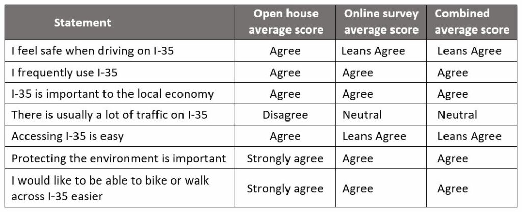
83 participants completed a survey in-person or online. Themes include:
• Safety while driving on I-35
• Safer and more connected bike and pedestrian access
• Increased access between downtown and the lakefront
• Infrastructure that supports community and economic development
• Walkability and improved public transit
• A corridor that supports the demands of tourism and industry
Respondent comments included:
• “Better on/off ramps. Most are hard to navigate. Not enough space/time to merge.”
• “More lanes available at busy merge points and exits near highway 2 east and grand / central Ave.”
• “Make it safe for pedestrians, cyclists to access the lake from downtown Duluth, as well as the ability to safely cross I-35 in other areas along the corridor.”
• “Better connection across I-35 for walkers and bikers.”
• “A sustainable city where people come to visit and live to take advantage of all that makes Duluth unique and special.”
• “A mix of businesses to serve both residents and tourists. Not overly burdening residents is important to me.”
• “Walkable streets, protected bike lanes that can access businesses. Being able to enjoy being downtown and see the lake, not ugly concrete.”
Comments on the online interactive map included:
• Improving intersections near Cloquet
• Creating an alternate route connecting to Hwy 61 to bypass the City of Duluth
• Increased connectivity from Lincoln Park to Lake Superior
• Increased connectivity to the Spirit Mountain neighborhood
• Improving the pedestrian bridge over I-35
• Improve pedestrian connections at the Century Avenue underpass
• Creating an exit from I-35 onto Garfield Avenue
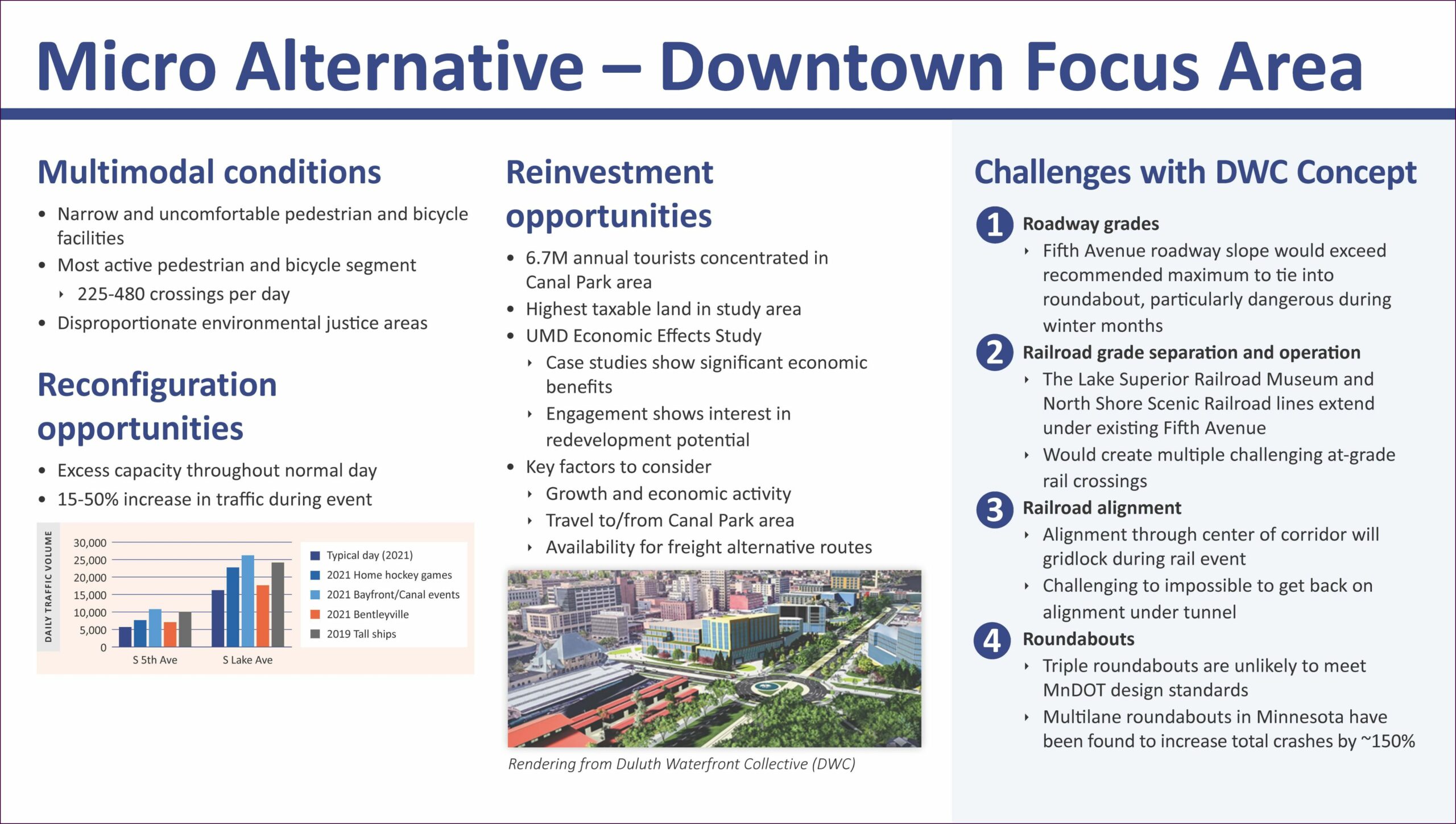
• Creating an at-grade parkway between downtown Duluth and Canal Park and the Bayfront area
• An improved pedestrian experience at the Lake Avenue intersection
• Modifying the London Road/I-35 intersection to enlarge lakefront greenspace
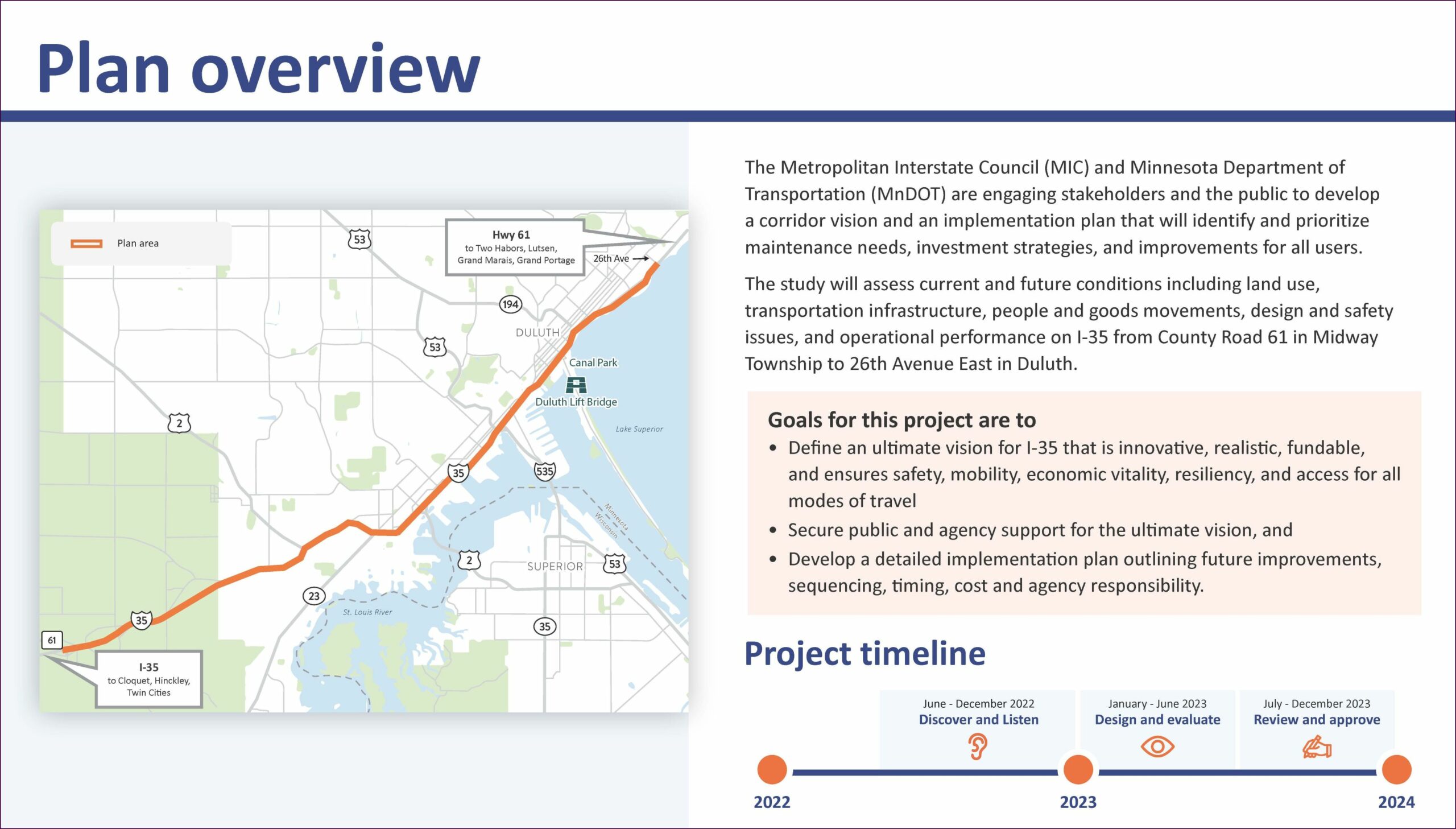
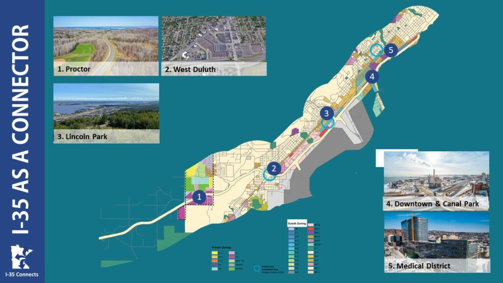
What We Know about the I-35 Corridor – Background Data
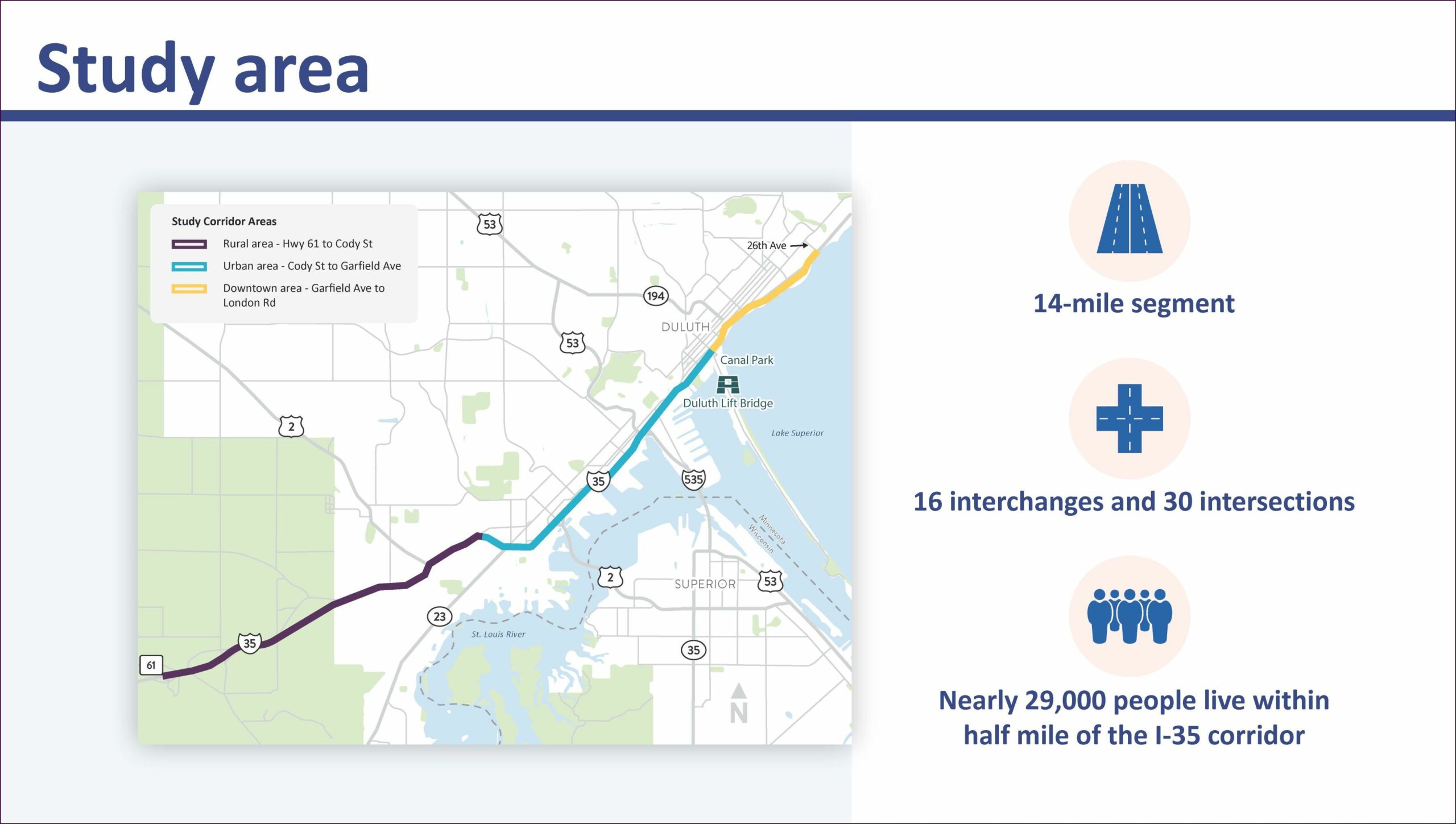
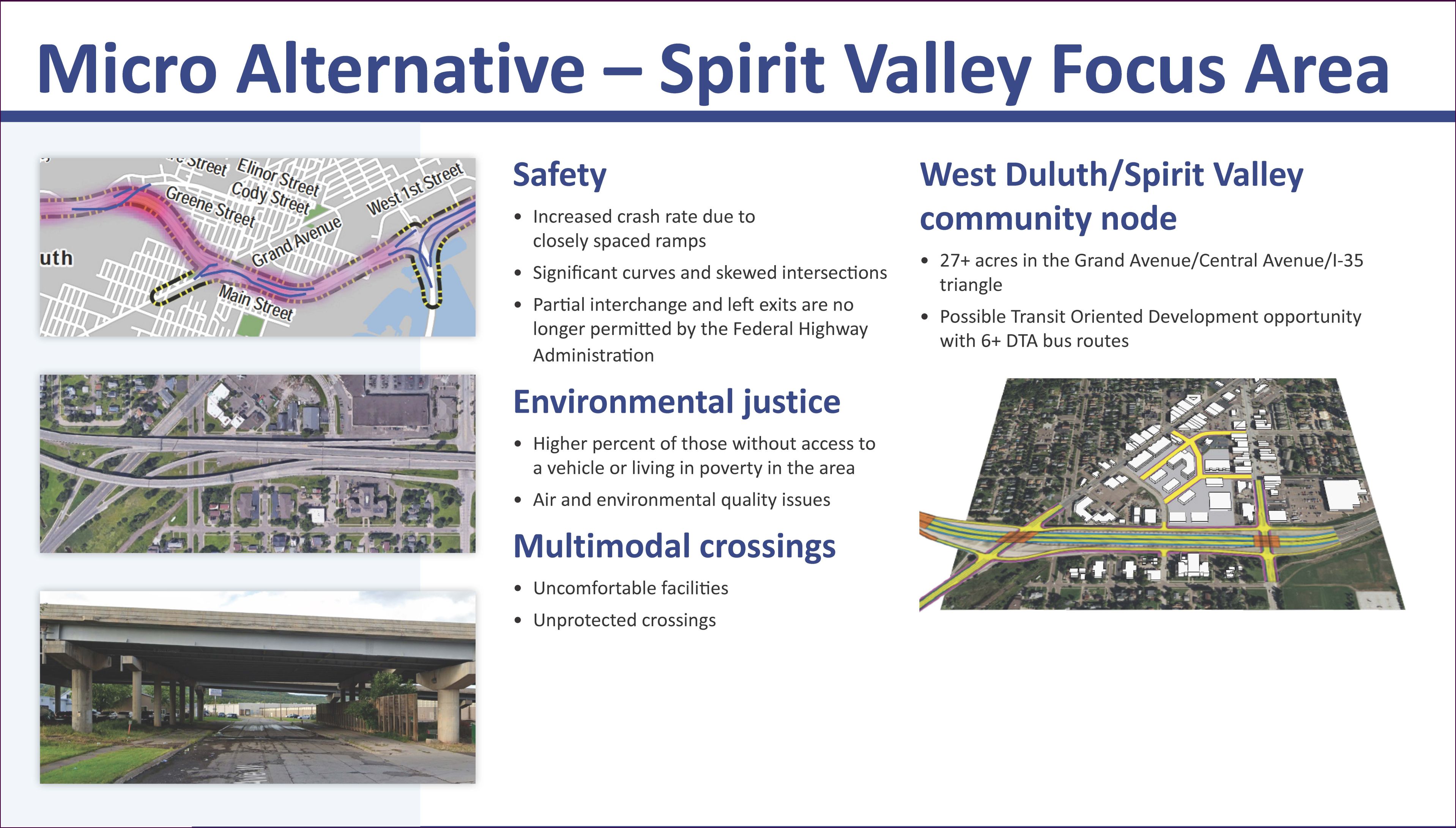
Background Nearly 29,000 people live within ½ mile of the 14-mile section of I-35. The section includes 16 interchanges and 30 intersections. Three distinct segments existing within the study section: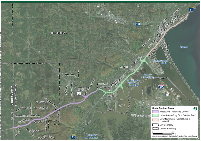 Rural – Midway Township to Cody Street. I-35 in this segment is mostly surrounded by undeveloped land with pockets of development at and near access points.Urban – from Cody Street to Garfield Avenue. I-35 in this segment is surrounded by low- to mid density residential, commercial, and industrial land uses.Downtown – from Garfield Avenue to 26th Avenue East. I-35 in this segment passes the Duluth central business district with increased residential and business density before density begins to decrease on eastern end.The plan will build on past studies including:
- Downtown Duluth Modal Connections Study
- Connections 2040
- Sustainable Choices 2045
- I-35 Bayfront Traffic Modeling & Event Traffic Control Plan
- 5th Avenue Bridge Planning Study
- Proctor Transportation Plan
- DTA Better Bus Blueprint
- Duluth-Superior Metropolitan Pedestrian Plan
- Duluth-Superior Metropolitan Bikeways Plan
- MnDOT District 1 Freight Plan
- Duluth Waterfront Collective
Context
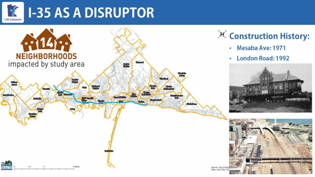
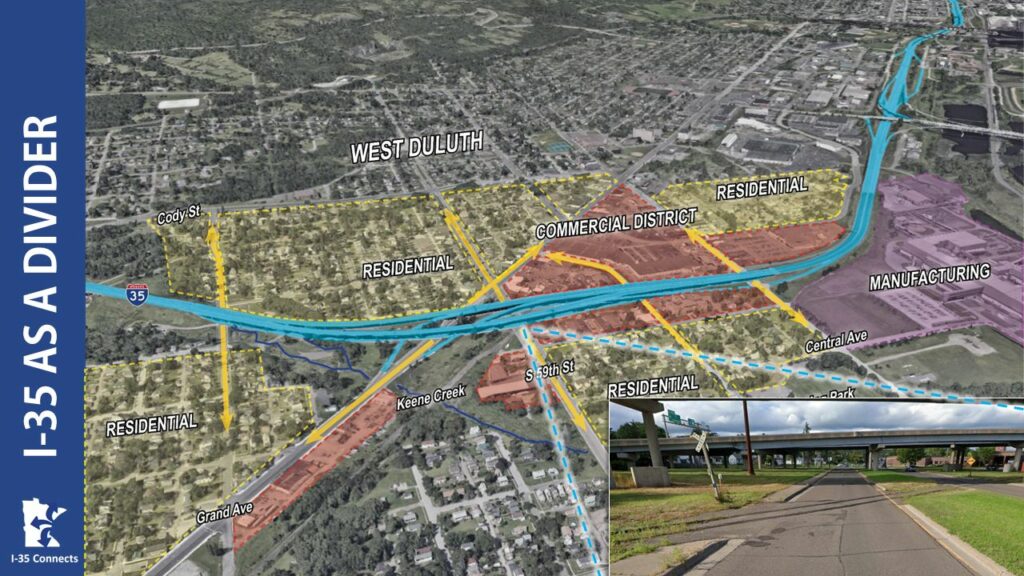
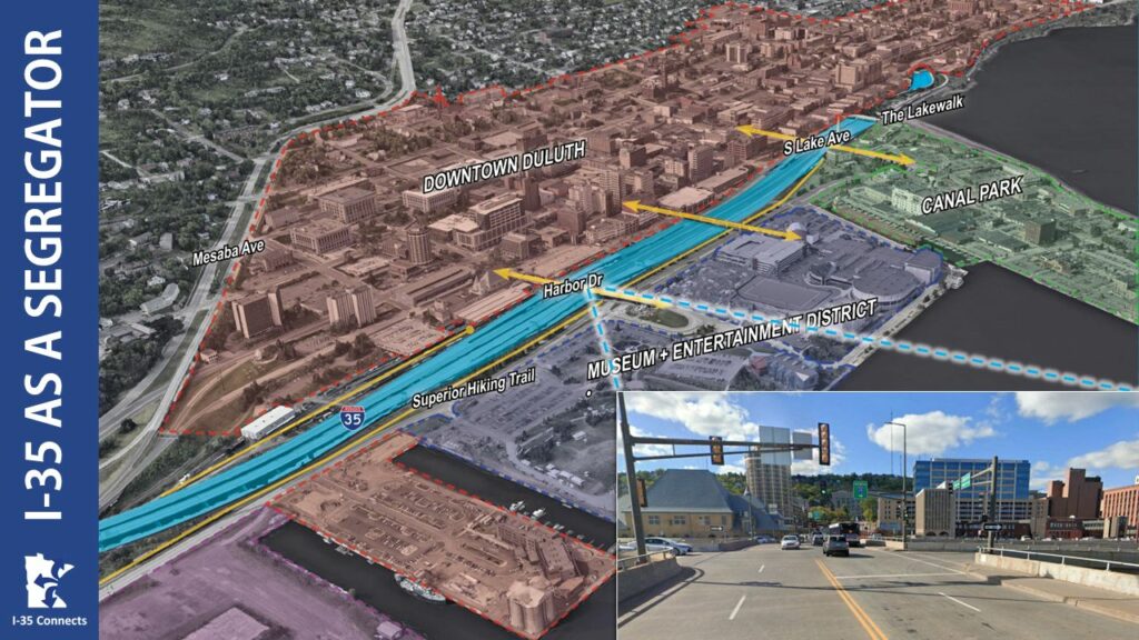
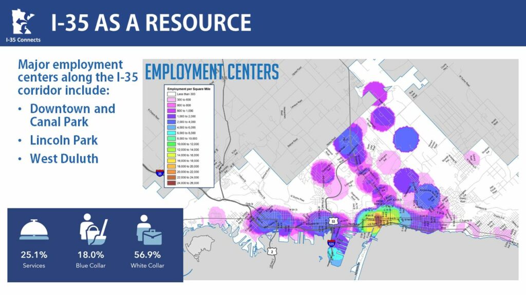
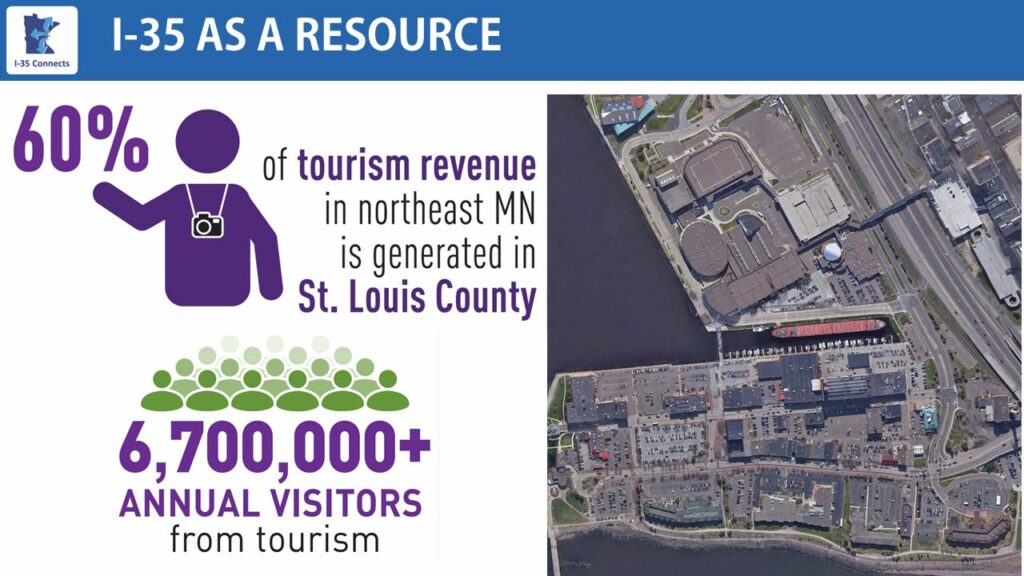
I-35 in Duluth serves/served many roles including as a disruptor, divider, segregator, connector, resource, and opportunity.
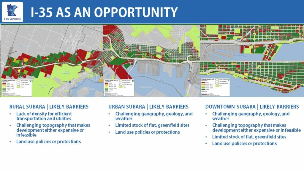
Likely barriers in rural subarea
- Lack of density for efficient transportation and utilities
- Challenging topography that makes development either expensive or infeasible
- Land use policies or protections
Likely barriers in urban subarea
- Challenging geography, geology, and weather
- Limited stock of flat, greenfield sites
- Land use policies or protections
Likely barriers in downtown subarea
- Challenging geography, geology, and weather
- Challenging topography that makes development either expensive or infeasible
- Limited stock of flat, greenfield sites
- Land use policies or protections
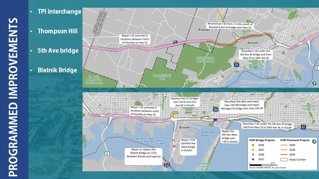
Planned/Programmed Improvements
Planned improvements include the Twin Ports Interchange (TPI), Thompson Hill, 5th Ave bridge, and the Blatnik bridge.
Existing Conditions
Pavement conditions in most segments are in good shape. Thompson Hill and Canal Park are at end of service life and the northern end is approaching end of service life.
67 structures along the corridor. 5 are functionally obsolete and 1 is structurally deficient.
12 retaining walls are present in MnDOT right-of-way. The oldest is the Thompson Hill wall and is 1,000 feet long and made of stone.
4 tunnels, including the Leif Erickson tunnel, for a combined 3,300 feet in length.
A significant investment in infrastructure exists within the I-35 corridor. If the I-35 corridor from Thompson Hill to 26th Ave E were reconstructed today it would cost more than $750,000,000 (in 2022 dollars).
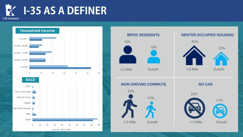
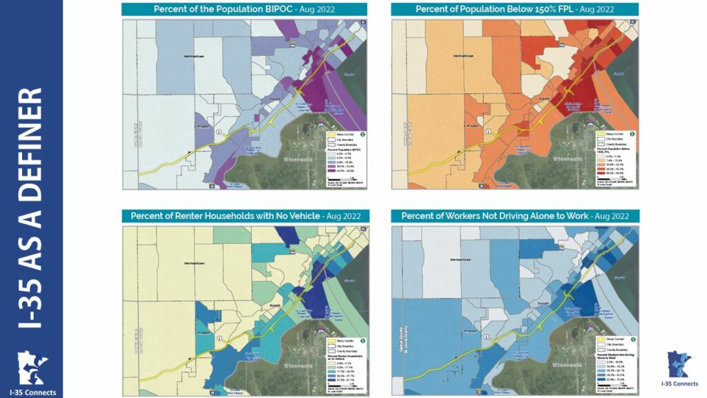
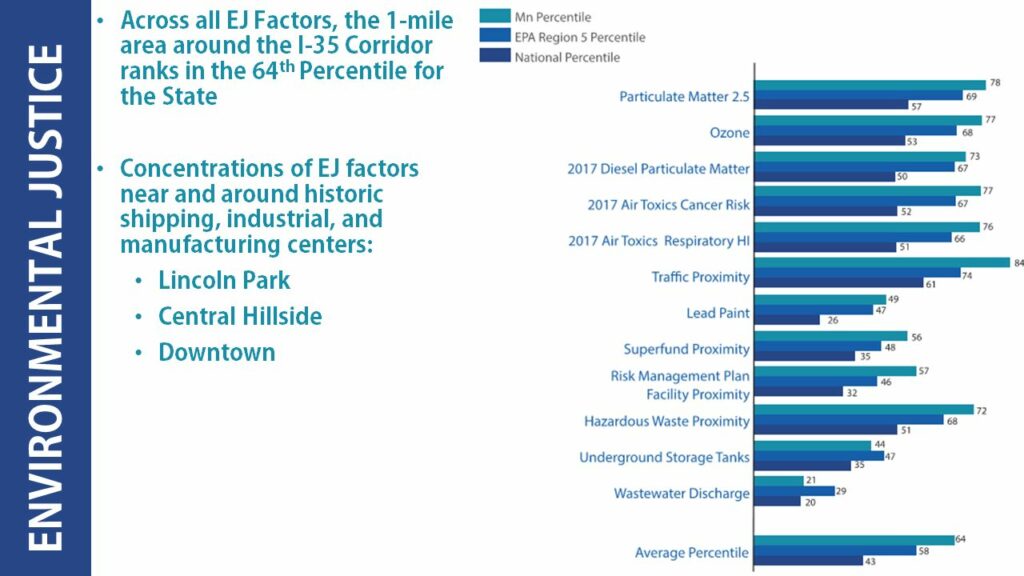
Environmental Justice
Across all Environmental Justice factors, the 1-mile area around I-35 corridor ranks in the 64th percentile for the State. This means that across all Environmental Justice factors, the 1-mile area is equal to or higher than where 64 percent of Minnesotans live across the state.
For example, in the graphic below, Ozone is noted at 77th Minnesota percentile and 53rd national percentile. Which means that Ozone in the 1-mile area is equal to or higher than where 77 percent of Minnesotan live and 53 percent of where people in the United States live.
Traffic Volumes
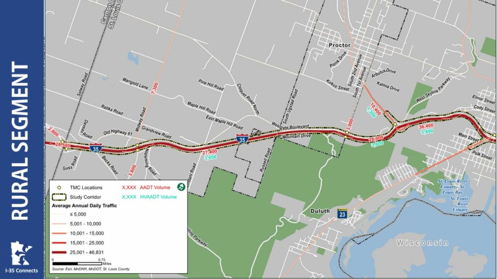
Rural segment traffic
Traffic: 27,000-36,000
Trucks: 3,000-3,400 (10%)
Traffic: 10,400
Trucks: 1,300 (12.5%)
Traffic: 3,600-7,300
Traffic: 4,300
Traffic: 3,000
Traffic: 2,800
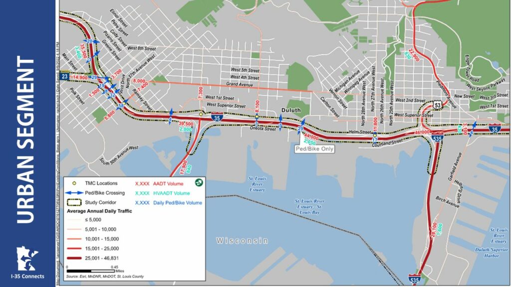
Urban segment traffic
• I-35
Traffic: 35,500-46,000
Trucks: 2,000-3,400 (5-10%)
• I-535 Blatnik Bridge
Traffic: 28,100
Trucks: 1,600 (6%)
• US 2 Bong Bridge
Traffic: 17,900
Trucks: 840 (5%)
• US 53
Traffic: 22,900
• Grand Ave
Traffic: 8,000-14,900
Daily Pedestrian & Bike: 29
• Central Ave N
Daily Pedestrian & Bike: 58
Pedestrian and Bicycle Bridge east of 37 ½ Avenue W
Daily Pedestrian & Bike: 29
• N 27th Ave W
Traffic: 11,800
Daily Pedestrian & Bike: 17
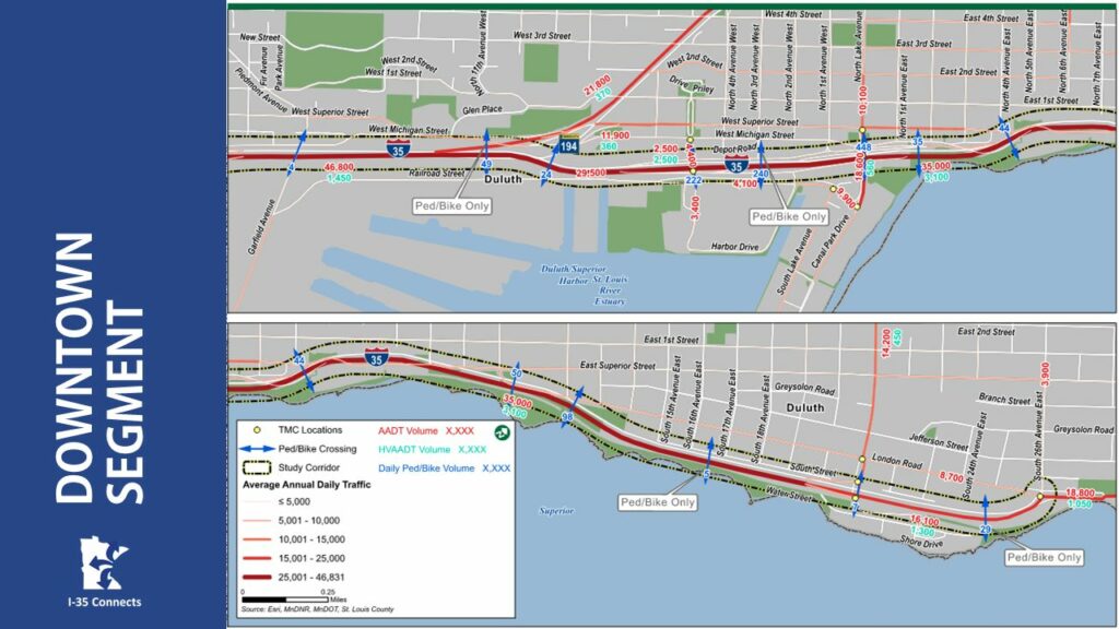
Downtown segment traffic
• I-35
Traffic: 16,100-46,000
Trucks: 1,300-3,100 (3-9%)
• Mesaba Ave
Traffic: 21,800
Trucks: 370 (2%)
• Lake Ave
Traffic: 18,600
Peds/Bikes: 448
• 5th Ave W
Traffic: 4,400
Peds/Bikes: 222
• 21st Ave E
Traffic: 14,200
~200 peds/bikes over 3 tunnels
Traffic Variability
- Rural area sees greatest monthly fluctuations
- Urban area is the most stable
- June-October 10%+ increase from annual average
- December-February 10% decrease from annual average
- Friday 16% higher than weekly average
- Monday & Tuesday 10% lower than weekly average
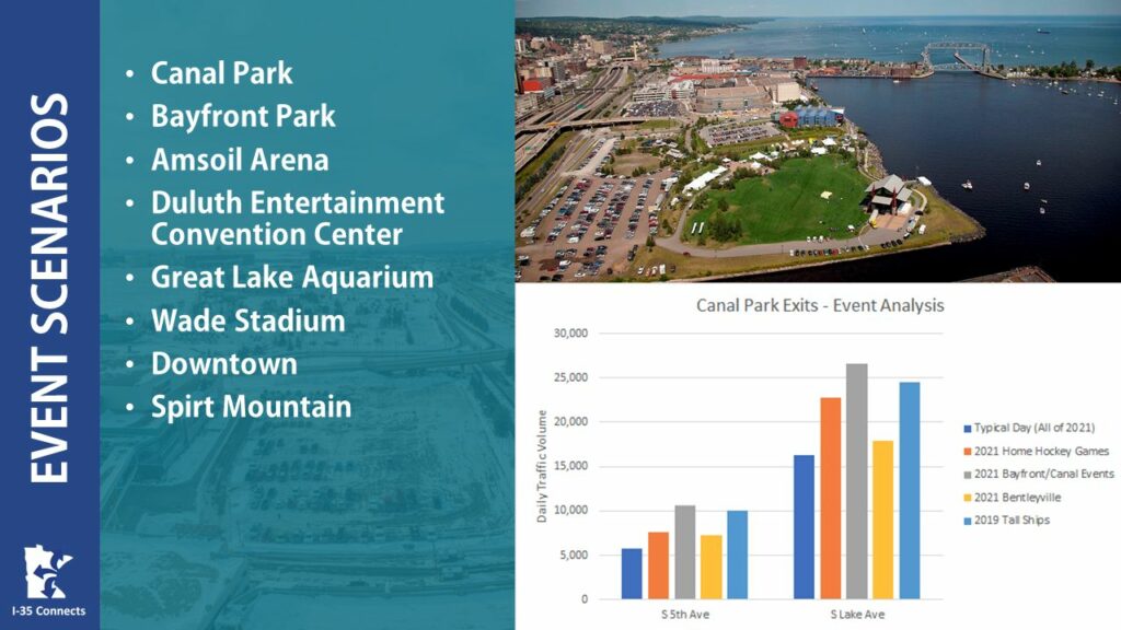
Events
Events at the Duluth Entertainment Convention Center and waterfront significantly effect travel demand.
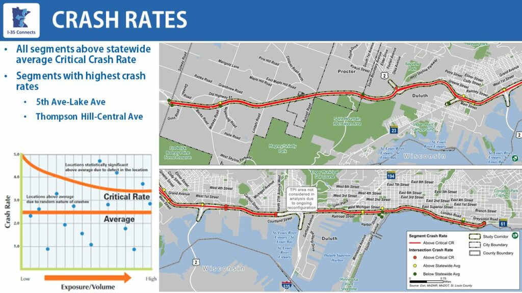
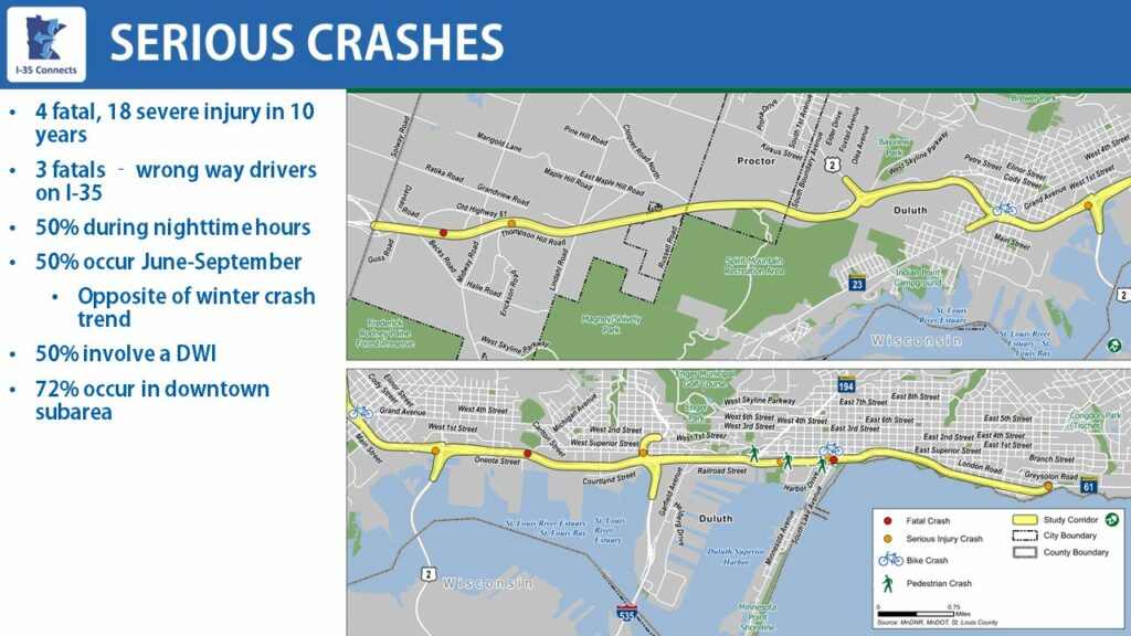
Safety