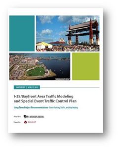
What
The purpose of this project was twofold:
● To develop short- term solutions in the form of a Special Event Traffic Control Plan to address the issues related to the mix of event-related, commercial and industrial traffic in the Bayfront/DECC/Canal Park area (implementable in the next 1-5 years); and
● To identify and plan for long-term infrastructure needs (implementable over the next 10-20 years) along the adjacent I-35 corridor.
Why
The project was prompted by the mutual interests of several stakeholder businesses and agencies:
● Bayfront area event managers and the City of Duluth identified many issues pertaining to traffic control in the Bayfront area. Problems with traffic congestion and difficulties accessing parking facilities on Railroad Street and at the DECC are most pronounced during the several simultaneous events that occur during the holiday season, but are also negatively affecting adjacent businesses and impacting other high-volume events at the Bayfront throughout the year.
● MnDOT District One is conducting planning and engineering assessments of future operations, maintenance and improvement needs for the I-35 corridor north of the ‘can of worms’ area, with an eye to separating the growing level of industrial traffic from the commercial/residential traffic in the Rice’s Point area.
● The Metropolitan Interstate Council (MIC) is conducting ongoing planning work to determine multi-modal transportation needs for the Duluth-Superior area, as well as the available system assets and projected financial resources to address those needs in the short- and long-term.
Who
● MnDOT District One, City of Duluth (Engineering and DEDA) and the Duluth Seaway Port Authority are providing financial assistance for a combined total of $63,000.
● Alliant Engineering, based in Minneapolis, Minnesota, was selected as the consultant to lead this project, based on their related experience and ability to deliver the project in a short time frame. Alliant developed the traffic control plan for the 2018 Super Bowl at US Bank Stadium as well as the wayfinding and traffic control plan for the Mall of America. The project manager is engineer Nick VanGunst.
● The Duluth-Superior Metropolitan Interstate Council (MIC) conducted the RFP process and coordinated funding to hire a consultant to conduct the project. It also provided data from its Travel Demand Model as well as in-kind staff assistance to schedule meetings and to serve as communications liaison between the consultant, project stakeholders and the public.
● Stakeholder participants included representatives from Bentleyville, Pier B, the DECC, MnDOT, City of Duluth Police, Engineering and Planning departments, the State Patrol and the Port Authority.
When (Project Timeline and Tasks)
September 2018 – May 2019
The project kicked off with a stakeholder meeting in September 2018 that focused on data collection (traffic and parking counts) to develop the short-term operational aspects of the Traffic Control Plan.
Traffic observations were conducted in the Bayfront area during the 2018 holiday event season and a technical group selected modeling scenarios, reviewed modeling results and developed short- and long-term recommendations. The project stakeholder group met several times between September 2018 and April 2019 to review the data and finalize the recommendations.
Implementation can begin by project stakeholders for events beginning in 2019.
Where
See study area map.
Key Issues
The study documents several observed issues including:
● Traffic congestion due to circulation and processing time at parking entrances
● Coordination difficulty among independent parking operations
● Lack of advanced and real-time parking and wayfinding information
● Lack of information about alternative transportation and parking options
Key Strategies
Strategies to address or mitigate the key issues were prioritized by degree of improvement combined with financial feasibility and implementation viability. The strategies are listed in detail but fall under several broad categories including:
- Outreach and Minimal Traffic Management
(e.g., marketing; pedestrian improvements; wayfinding signage)
- Parking and Traffic Circulation Management
(e.g., integrated management; multiple entrances; downtown and assigned parking)
- Traffic Operation Improvement
(e.g., signal timing; separate NB/EB traffic on 5th Avenue ramp)
- Circulation Improvement
(e.g., change Harbor Drive to 1-way; create Lake Ave/Canal Park Drive 1-way pair)
- Roadway or Network Improvement
(e.g., reconstruct 5th Ave W. roadway/sidewalk; add roadway capacity to Railroad St)
- Transit/Railway Improvement
(e.g., add dedicated bus lane via 5th Ave W/Harbor Dr; add P&R shuttle option)
- System or Capacity Improvement
(e.g., construct a parking ramp near the power plant; utilize apps for traffic & parking info)
To View Complete Plan
See “Document” tab, above.

