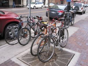
Bike-Friendly Duluth?

As cities across the U.S. are battling it out for the distinction of “Most Bike-Friendly,” does Duluth stand a chance of being included some day in the Top-50 list?

You might think that our long winters and steep hills would prevent this. But think again: two of the top-ranked cities, Portland, Oregon (back to #1 this year) and Minneapolis (dropped to #2) are neither sunny nor warm places for much of the year-Portland is rainy , cool and hilly and we know all about the cold and snowy winters of Minnesota.

Consider also that two other cities – Boulder, Colorado (#3), which is comparable to Duluth in its total population and San Francisco, California (#8) – feature many or more of the same topographical obstacles we face here.

So what does it take to get on this list?

In addition to having a significant interest in cycling on the part of its residents, a city needs to be willing to be proactive and try new things.

In some ways Duluth has operated this way, to promote bicycling as a transportation option. For example,

  • The DTA was an early adopter of the bike racks on the front of buses.
  • There is a dedicated lane on Park Point (from April to October) for non-motorized users.The Bong Bridge (U.S. Hwy 2/53) connecting Duluth and Superior includes a separate, protected bicycle and pedestrian lane.
  • The City of Duluth and St. Louis County are creating space for bicyclists and pedestrians by adding shoulders where possible when reconstructing streets, including on parts of Arrowhead Road, Wallace Avenue, Snively Road and the new space created on Glenwood Street.
  • The Lakewalk (and the future Cross City Trail link that will connect the Lakewalk to the Munger Trail) is a bike-friendly, off-street link that will  run the entire length of Duluth.

These are highly visible bike-friendly amenities.  However, what is missing is just as noticeable:

  • Roads commonly labeled by local bicyclists as unsafe or dangerous—Superior Street in Downtown Duluth, Woodland Avenue around UMD, and 4th Street near the hospitals —are the very streets that should be the most accommodating. Although these major streets carry a quite a bit of car traffic, they are also ideal for bicycling, as they provide the most direct route to major destinations and generally have less severe slopes than other streets.
  • Other streets and public spaces, including intersections and routes on top of the hill near the Mall where bicycling has not been given a whole lot of thought, are enormous impediments to bicycling in this region.

But we also have some opportunities in our near future for the Twin Ports community to be proactive in a couple of upcoming projects:

  • Belknap Street, in the City of Superior,  is being considered for some type of bicycle accommodation that would complement the planned bike lanes on Tower Avenue as part of their downtown streetscape project.
  • A big opportunity in Duluth is the new DTA Multimodal Transportation Terminal, a part of which is a new “northwest passage” skyway connecting Downtown Duluth and the DECC.  This facility has the opportunity to serve as a bike station as well as provide a safe and convenient bicycle path across I-35 to and from the core downtown area.

So, what do you think? What’s your experience with biking in Duluth? Do we have the commitment that’s necessary to bring our city up to the level of one of America’s most bike-friendly cities? What do you see as opportunities—or opportunities lost—for improving biking here?

How to Get From Here to There: Access and Connectivity in the Lincoln Park Neighborhood

Transformative changes are taking place in the Lincoln Park neighborhood.

View from the new Western Middle School
Looking down from the new Western Middle School site to the new Clyde Iron recreational facility (lower left)

A major redevelopment of the old Clyde Iron industrial complex was just completed. A new Western middle school is rising on the hillside. A segment of the Cross-City trail will be winding through this neighborhood in the next few years as it spans the city from east to west along the waterfront.

Here at the MIC, we see these exciting new community-oriented developments and start to think about…access, connectivity and land use.

We’re kind of geeky that way.  Let me explain.

Access is about making sure that people, who have different mobility options and who need or want to use these facilities, can get to them easily and safely.

Connectivity is about making sure that usable and intuitive transportation links exist between the new developments and other destinations.  At the base of this this neighborhood, popular destinations would include Wade Stadium, Wheeler Field and Harrison Park.  And along the top of the ridgeline are Skyline Parkway and the Superior Hiking Trail.

Complicating the situation, the land uses for these facilities are distinctly at odds with each other.

The middle school is located on the edge of a traditional residential neighborhood that is easy to walk through, with square blocks, houses close together and minimal, slow moving traffic. It can actually be characterized as a semi-rural area, with few sidewalks and narrow streets, many of which dead end into large open spaces.

The Clyde Iron complex, in contrast, which also houses a Boys and Girls Club, indoor athletic fields, year-round ice rink, and in the future a nearby Duluth Children’s Museum—is located in an established industrial area, where a significant level of pedestrian traffic was not anticipated.

Last but not least is the huge barrier of the railroad tracks that run between the school and the Wheeler Field park space and the Denfeld neighborhood immediately west of the school.

So, a number of our current studies are taking a look at how people move around this neighborhood in light of the new developments.  Creating a walking corridor between these facilities is a key transportation piece for this neighborhood.

The Lincoln Park Pedestrian Corridor Plan is focused on creating a walking route up and down the hill from the middle school to the Clyde Iron complex.

An upcoming Safe Routes to School site assessment will further examine the school and walking and bicycling routes to the middle school to the surrounding neighborhoods.

And a larger neighborhood wide transportation study, the Lincoln Park Multimodal Transportation Assessment will build off of the other 2 studies and focus on all modes of travel in the neighborhood.

Lots of work is ahead.  We’ll keep you posted.

Photo credit: Scott Byykkonen

Co-writing credit: Rondi Watson

Roads, Trails, or Both?

Priorities for Duluth’s Transportation System

As discussed in our previous blog, approximately $45 million in federal funds are being programmed for Duluth area transportation projects for 2012-2015.

The draft Transportation Improvement Program (TIP) spells out costs and timeframes for a total of 36 high-priority projects over four years and is now open for public comment.

Balancing the needs of all users

It seems we easily divide ourselves into those who drive versus those who ride the bus versus those who bike and so forth….an “us versus them” scenario.

Well, in reality the transportation system—and the public spaces they are a part of—are used by people in a much more complex way. You might drive to your job or to shop, but there will always be some amount of walking involved, from car to final destination and back again. You might use the sidewalks for walking from place to place, but also for stopping to talk to your neighbor in a common space. You might ride your bike down the big hill but put it on a DTA bus for the trip back up.

Looking through this lens, from the perspective of the users of the transportation system, you can see how this TIP has a major focus on how to really connect people in the safest and most efficient way possible. 

Continuing to fix the highways

Preservation work on the two major bridges is needed to refurbish the Blatnik (I-535) in 2012 and the Bong (US Highway 2) in 2014. These TIP projects not only have the highest price tags and but also will receive the most attention—yes, just when the I-35 reconstruction “megaproject” is finished, there will be several more years of high-profile road construction projects, on the bridges this time!

Improvements for those who walk, bike, or take the bus

While the highway projects are devoted solely to cars and trucks, funding is also included to provide a safe alternative to driving.  A paved pedestrian and bicycle pathway, running parallel to I-35, will connect the whole city from west  to east. The Munger Trail will eventually extend all the way to the Lakewalk by constructing short segments of a new Cross-City Trail each year. The popular Duluth Lakewalk will in turn be extended from 60th Avenue East to Highway 61, and then out to Brighton Beach up the north shore.

Funding for the Duluth Transit Authority will purchase new buses and provide operating support for both its regular route and STRIDE bus service.

And thanks to recent Complete Streets efforts in Duluth, local street projects will take into account how the roads are being used by people every day and will be designed accordingly.

The projects funded in the draft 2012-2015 Duluth area TIP balance the need to move vehicles efficiently with the needs of all people who use these public spaces, including those who utilize public transportation, those who traverse the roads by bicycle and those who are on foot.

Which makes sense to us – what do you think?

Who, Me, Bike to Work? Yes, You!

When is the last time you smelled the lake air during your morning commute?

Or pulled into the parking lot with a big smile on your face, pumped with endorphins and ideas? Or lost a few pounds just by traveling back and forth to work every day?

Likely never, if you slide behind the wheel of your vehicle each morning.

But what if one day you left the car in the driveway and rode a bike instead?

On Friday, May 20th, we invite you to ride your bike to work. To reward your commute, we’ll have a couple of bicycle stations open from 6:30 am to 8:30 am with

  • Coffee, water and refreshments
  • Bike mechanics to look at brakes, tire pressure and other safety checks
  • Advance copies of the new and improved Duluth-Superior Bike Map

The bike stations will be located at:

  • Lake Ave & Superior Street in Duluth (Minnesota Power Plaza)
  • Tower Ave & Belknap Street in Superior (City Center Park)

Give biking to work a try – for just one day. Stop by and say hello.