Carless in Duluth

It’s no secret that we Americans are in love with our cars.

They demonstrate our status and standing in society.

The way we’ve invested in roads and highways and the way we’ve developed our cities pretty much mandates that you need to own a car to be able to access jobs, food, education and recreation.

Driving a car has become the default mode of travel for almost all people for every trip of any distance.

And here in Duluth, perched on a steep hill with prominent winters, it makes sense that people want to drive.

So why would a person choose not to?

Video documentary and panel discussion

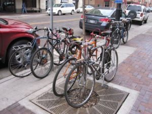
Carless in Duluth, a video documentary about people who walk, bike, or take the bus instead of driving, will premiere on:

Tuesday, March 20, 2012
6:00 pm
Teatro Zuccone
222 East Superior Street, downtown Duluth

Following the video, there will be a panel discussion with engineers, planners, and other experts in the area.  Afterward, an informational tabling session will be held in the atrium where food and drinks will also be available.

Area bike and ped projects, and lots of them

The event, hosted by the Healthy Duluth Area Coalition, follows a series of public meetings that were hosted throughout Duluth about one month ago.  At each meeting, residents were given the opportunity to learn about ongoing and upcoming bicycle and pedestrian projects happening all over the city, including the Cross-City Trail, the Duluth Citywide Sidewalk Study, and the Duluth Traverse Mountain Bike Trail, and gave their feedback about their interest in these projects as well as other potential ideas. Over 50 residents participated in these meetings.

The Carless in Duluth premiere and transportation forum on March 20th will conclude this series of public outreach events. Organizations including the Duluth Transit Authority, the Metropolitan Interstate Council, City of Duluth Engineering, and the Bike Cave Collective have already confirmed their participation in this event, with pending confirmation from the Northern Lights Express, COGGS, and the UMD Cycling Club.

Check it out – it’s free and open to the public.

How to Get From Here to There: Access and Connectivity in the Lincoln Park Neighborhood

Transformative changes are taking place in the Lincoln Park neighborhood.

View from the new Western Middle School
Looking down from the new Western Middle School site to the new Clyde Iron recreational facility (lower left)

A major redevelopment of the old Clyde Iron industrial complex was just completed. A new Western middle school is rising on the hillside. A segment of the Cross-City trail will be winding through this neighborhood in the next few years as it spans the city from east to west along the waterfront.

Here at the MIC, we see these exciting new community-oriented developments and start to think about…access, connectivity and land use.

We’re kind of geeky that way.  Let me explain.

Access is about making sure that people, who have different mobility options and who need or want to use these facilities, can get to them easily and safely.

Connectivity is about making sure that usable and intuitive transportation links exist between the new developments and other destinations.  At the base of this this neighborhood, popular destinations would include Wade Stadium, Wheeler Field and Harrison Park.  And along the top of the ridgeline are Skyline Parkway and the Superior Hiking Trail.

Complicating the situation, the land uses for these facilities are distinctly at odds with each other.

The middle school is located on the edge of a traditional residential neighborhood that is easy to walk through, with square blocks, houses close together and minimal, slow moving traffic. It can actually be characterized as a semi-rural area, with few sidewalks and narrow streets, many of which dead end into large open spaces.

The Clyde Iron complex, in contrast, which also houses a Boys and Girls Club, indoor athletic fields, year-round ice rink, and in the future a nearby Duluth Children’s Museum—is located in an established industrial area, where a significant level of pedestrian traffic was not anticipated.

Last but not least is the huge barrier of the railroad tracks that run between the school and the Wheeler Field park space and the Denfeld neighborhood immediately west of the school.

So, a number of our current studies are taking a look at how people move around this neighborhood in light of the new developments.  Creating a walking corridor between these facilities is a key transportation piece for this neighborhood.

The Lincoln Park Pedestrian Corridor Plan is focused on creating a walking route up and down the hill from the middle school to the Clyde Iron complex.

An upcoming Safe Routes to School site assessment will further examine the school and walking and bicycling routes to the middle school to the surrounding neighborhoods.

And a larger neighborhood wide transportation study, the Lincoln Park Multimodal Transportation Assessment will build off of the other 2 studies and focus on all modes of travel in the neighborhood.

Lots of work is ahead.  We’ll keep you posted.

Photo credit: Scott Byykkonen

Co-writing credit: Rondi Watson

My Awesome Walk to Work

Snow-covered section of the Superior Hiking Trail in Duluth MN

My Facebook post today reads: “Another awesome walk to work this morning on the Superior Hiking Trail—despite the snow—or maybe because of it!”

Within seconds a friend (an actual friend, in this case) responded “I did the same. I love Chester Park.”

Another commented “You are the luckiest commuter ever!”

This exchange reminded me of the simple, real-life benefits of one of our favorite concepts here at the MIC: multi-modal transportation networks.

It’s all about options

From a transportation planning perspective, a multi-modal transportation network refers to a balance of  infrastructure that supports multiple modes of travel — a mix of roads, air, marine/port, rail, public transportation, bicycle and pedestrian facilities (including paved and non-paved trails).  This mix is plainly visible on any given day in the Duluth-Superior area.

From a societal and governmental perspective, multi-modal transportation networks have been widely supported because a balanced transportation system encourages economic growth, reduces congestion and environmental impacts, and improves mobility and access to transportation.

From my personal perspective, though, a multi-modal transportation network means that I have options. It was just too nice of a morning to get in my car and drive (the very walkable distance of) two and a half miles.

Trails as commuter pathways

One big advantage of living in Duluth, Minnesota, is the proximity of urban areas to green spaces. A multi-modal system, in this city, means that I can walk out my back door onto the Superior Hiking Trail, which in turn intersects with our urban streets infrastructure across Skyline Parkway (as scenic a walk as you could ask for), down through a couple of local neighborhoods and to our downtown office.

And a community-wide vision is emerging for Duluth to become the premier trail city in North America. Developing an inter-connected trails system will provide not just outstanding recreational opportunities but compelling transportation options as well.

Quality of life improvement

Bottom line, I don’t have to get in my car and drive every time I need to go somewhere. I’m able to travel on foot (or by bike or by bus), and I consider that a big quality of life enhancement.

How about you?

Do you have an awesome walk to work of your own?  Would you like to be able to walk or bike more often in your daily life?  Does it make sense to continue to fund multi-modal transportation networks? (More on that topic to follow…)

Our Love/Hate Relationship with Central Entrance

Just last week I dropped a friend off near Arrowhead Road and Highway 53 just before 8 a.m. and headed toward my office in downtown Duluth.  I glanced at the dashboard clock and it said 7:58.  I had anticipated a congested trip but traffic was fairly light.

Love It

I made my way downtown thinking about my upcoming work day, scored a (free) parking spot, and to my surprise saw my car clock said 8:05.  Seven minutes to go five miles on Central Entrance, of all routes.  I had to admit that was an easy and direct commute.

Hate It

Fresh in my memory, however, are recent after-work trips to Miller Hill to run errands where I waited out more than one cycle of traffic light changes at Arlington Road and Central Entrance.  I–like everyone else–get frustrated by sitting in traffic.

But I think that we get frustrated much quicker than big city drivers who have horror stories about the amount of time they get stuck in traffic.  Relatively speaking, we have it pretty good.  So what is it about Central Entrance that makes many of us want to avoid it?

The Bigger Picture

From a transportation standpoint, it’s not just about reducing vehicle congestion on this road, but about balancing the needs of all users.  In transportation planning, we think about  improving Central Entrance from many perspectives, including:

  • Mobility (getting travelers through the area)
  • Access (getting customers to local businesses)
  • Multimodal (accommodating pedestrians, bicyclists and transit users)
  • Safety (for all)
  • Livability (for neighborhood residents)

Someday (The Vision)

The City of Duluth has been thinking about these things as well.  A long term vision for Central Entrance was recently identified, with input from businesses and residents, in its Central Entrance-Miller Hill Small Area Plan.  The vision for the corridor is for a more walkable area that would regain its focus as the “main street” for the Duluth Heights neighborhood.

Where We Come In

As a step toward implementing the plan, the City has asked the MIC to examine the transportation challenges on the Central Entrance corridor.  We will be collecting data, surveying residents, and making recommendations that will help in achieving the goal of eventually transforming Central Entrance into a more comfortable and attractive part of town.

There will be more information posted via this blog as our work progresses, but meanwhile, you can get more information about the Central Entrance Corridor study on our website.

Your Thoughts?

So what do you think about Duluth’s neighborhood-oriented vision for Central Entrance?  Can you picture a balanced transportation system like I describe above?


Nobody Knows the Sidewalks I’ve Seen

Duluth Sidewalk Inventory

You might have seen a wiry, long-haired fellow wandering the streets of Duluth staring intently down at his phone over the last few weeks. That guy is me, the MIC’s intern for this summer. And that phone is actually a GPS device called a Trimble Juno. I’m using it to record the condition of every section of sidewalk in the city. With my trusty GPS in hand (which I call Lil’ Julie) I walk slowly through the streets recording three different bits of information for the Duluth Sidewalk Inventory.

Condition Rating

The first is the sidewalk condition rating. The options are Excellent, Good, Fair, and Poor. “Excellent” is basically for brand new sidewalks, immaculate and brilliant white. “Good” means that they don’t have any cracks and haven’t sunken or heaved. “Fair” means that there are cracks and vegetation growing up through those cracks. They generally have some sunken or tilted sections that leave small raised edges. “Poor” sidewalks are pretty rough. These have major surface defects—broken pavement, big holes and the like.

Curb Ramps

The second criterion is the condition of the curb ramps. A curb ramp is that sloped portion of sidewalk on each corner. It allows disabled persons to transition from the street level to the sidewalk level and vice versa. These are rated along the same scale as the sidewalks. Some sidewalks don’t have curb ramps at all. In situations like that the sidewalks are almost entirely inaccessible to disabled persons.

Obstructions

The third thing that I do is note any obstructions in the sidewalk. These generally consist of raised edges greater than ¾” and overgrown vegetation; though sometimes I do spot obstructions like raised utility access panels or signs in the sidewalk.

Targeting Scarce Resources

It’s not an easy job (did you know there are over 400 miles of sidewalks in Duluth?), but it really is important information to collect. With this data the city can target its resources to the spots that are in greatest need of repair. Lots of people, young and old, able-bodied and disabled persons alike, depend on these sidewalks for their own personal mobility and freedom. It’s good to know that the MIC’s sidewalk inventory works toward improving that.

Do You Have Your Own Examples?

Follow my progress on the MIC’s Facebook page. I’ll be posting updates on my progress all summer and adding pictures in the Unhappy Sidewalks of Duluth photo album. Do you have some real gems in your neighborhood? Some epic branches blocking your morning run? We’re also looking to identify sidewalk segments—in any condition, good or bad—that are important because they’re so heavily used.

Take a picture and post it to our wall or email it to me.